| Name of walk | Walla Crag to High Tove & Watendlath |
| Date of walk | 2025-05-20 |
The dry weather was continuing so Sue and I drove to Ashness Bridge in order to walk up to Walla Crag, Bleaberry Fell, High Seat and High Tove, continuing down to Watendlath cafe and returning along the valley floor. It was an ideal day to tackle The Pewits, a peat bog between High Seat and High Tove, notoriously wet at the best of times. We would get a welcome surprise here! The walk was just under 10 miles.

We parked in the National Trust car park at Ashness Bridge. The track up to Walla Crag starts just opposite the bridge.

We took the sign that said Great Wood then turned right at this sign post. The sign warnings said it was steep, but it is nothing compared to some routes. It is just a diagonal climb towards the top of Cat Gill.

Great views over Derwent Water to Castle Crag, High Spy, Maiden Moor and Catbells.

Causey Pike and Grisedale Pike on the left.

View panorama. Left click to enlarge, click again to return.

Catbells reflections.

Cat Gill with Walla Crag on the right.

Bassenthwaite Lake in the distance.

Walla Crag summit.

Lovely!

Looking over Keswick towards Skiddaw.

Summit selfie.

View from the summit crag to Bleaberry Fell.

Our route ahead. Bleaberry Fell on the left.

View back.

View back as we head higher. In August this is all purple heather.

Sue's photo of me heading up Bleaberry Fell.

The last section is a pitched path.

Another view back.

As we reach the summit ridge there are views over to Blencathra and Clough Head.

Dodd and High Rigg in the foreground.

Great 360 degree views.

We have a brief stop in the summit shelter.

We head for High Seat.

View back to Bleaberry Fell. The route has a new path since my last visit.

The nurses that decided they would follow us to High Tove and Watendlath cafe rather than take the track down to Ashness Bridge.

High Seat summit. Dale Head and High Spy on the left.

View back to Bleaberry Fell.

Grange Fell below. Above left is Kirk Fell and Great Gable. High Spy is the main bulk.

The route to High Tove. Pointy Pike o'Stickle and Grey Friar are just to the right of High Raise.

Thirlmere below with Helvellyn behind.

The way ahead.

There is now a stone path through The Pewits (an area of peat bog). It is wonderful! Such easy walking. No more having to wait for a dry period to do this walk.

Sue's photo of me.

This is what we used to have to walk through.

This is now an enjoyable stroll.

High Tove summit looking towards Armboth Fell. Helvellyn to the left, then Nethermost Pike, Dollywaggon Pike, Fairfield and Seat Sandal.

We turn and go through the gate for the path down to Watendlath. Glaramara, Great Gable, Honister Pass, Pillar and Dale Head in view.

Looking down on Watendlath Tarn and the cafe.

The valley that we will follow the beck back.

Ah! They still use the treddle base of old Singer sewing machines as tables. My grandmother had an identical one.

They didn't stint on the jam!

There is no inside seating, but there is now some awnings to keep out sun and rain.

Suitably refreshed we visit the tarn.


Nice tree reflections.

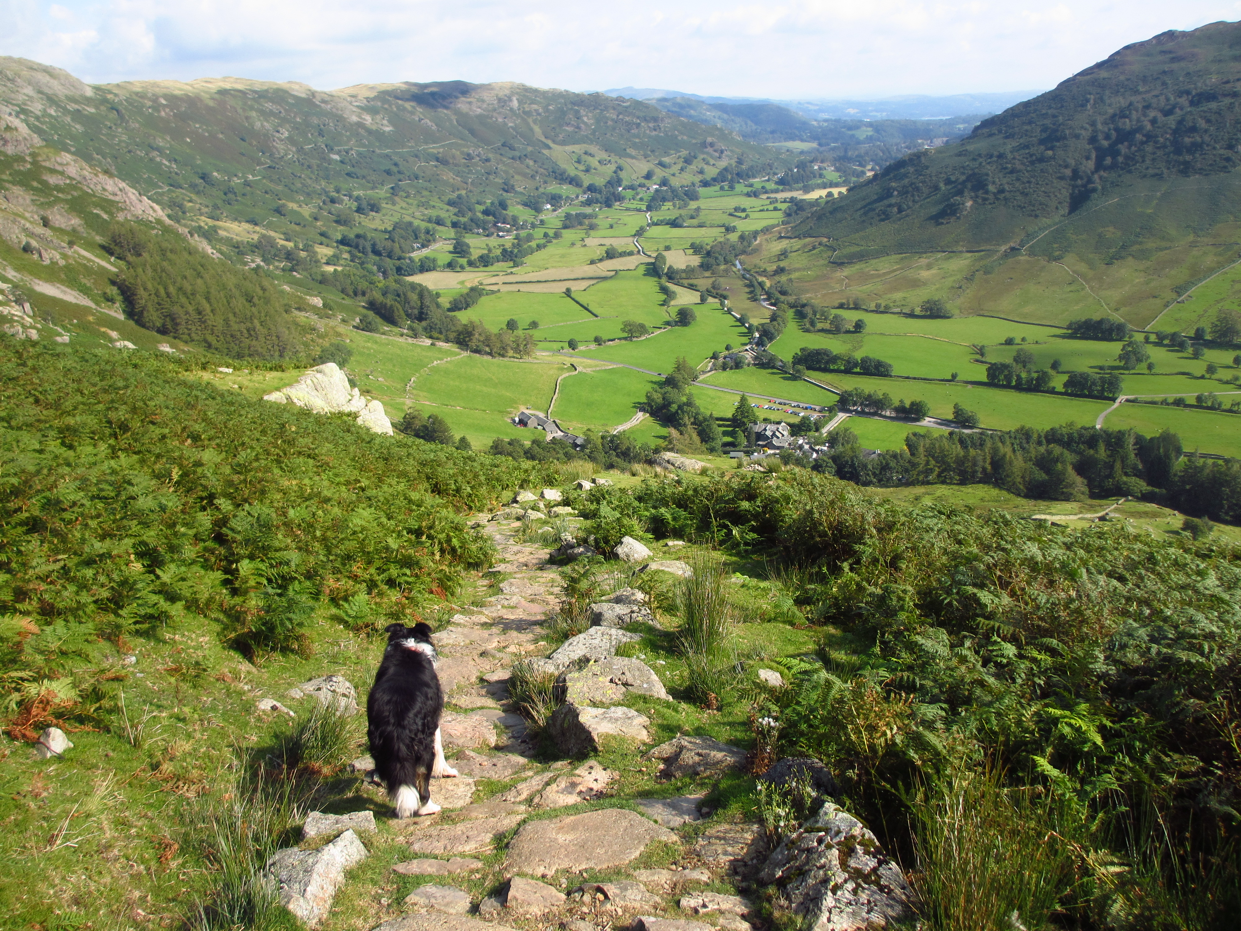
We head over Watendlath Bridge for our path back along the valley. There is a road route too.

View back to Watendlath.

Our route ahead.

It is a rocky underfoot route, but easy enough and far better than a road walk.

Watendlath Beck.

No sign of Kingfishers.

View back.

Tree reflection.


Belted Galloways.

We cross the bridge.

We go through the woods. Eventually this path comes out to the road. There is a short road walk before Surprise View is reached.

Surprise View.

Looking down on The Lodore Falls Hotel.

Looking down on The Mary Mount Hotel.
Then there is another short road walk back down the hill to Ashness Bridge NT car park. An excellent walk on a superb weather day. The 10 mile walk took us 6hrs and 10 minutes. We timed the walk well as the rain started just a few minutes after we drove through Keswick.
Jo.