| Name of walk | Six Fells From Causey Pike to Barrow |
| Date of walk | 2009-08-12 |
| Distance walked (miles) | 8 |
| Duration of walk | 6 hours 0 minutes |
| Weather | Sunshine, mist then rain |
| Peaks on walk | Causey Pike, Scar Crags, Sail, Eel Crag (Crag Hill), Outerside and Barrow |
| Walked with | Ged and blind Kas |
| Parking | Roadside at Uzzicar |
Yesterday Ged, kas and I parked on the side of the road near Uzzicar, which is just below the slopes of Barrow Fell, in order to climb Causey Pike (2035ft), Scar Crags (2205ft), Sail (2530ft), Eel Crag (Crag Hill on Ordnance survey maps) (2749ft), Outerside (1863ft) and Barrow (1494ft). A walk of about 8 miles. When we set off from home the clouds were down, but the weather was forecast to improve then deteriorate about 3pm. We were ready to walk by 11am, and the weather had improved, but it would be a race to get to Eel Crag before the bad weather obliterated the view.

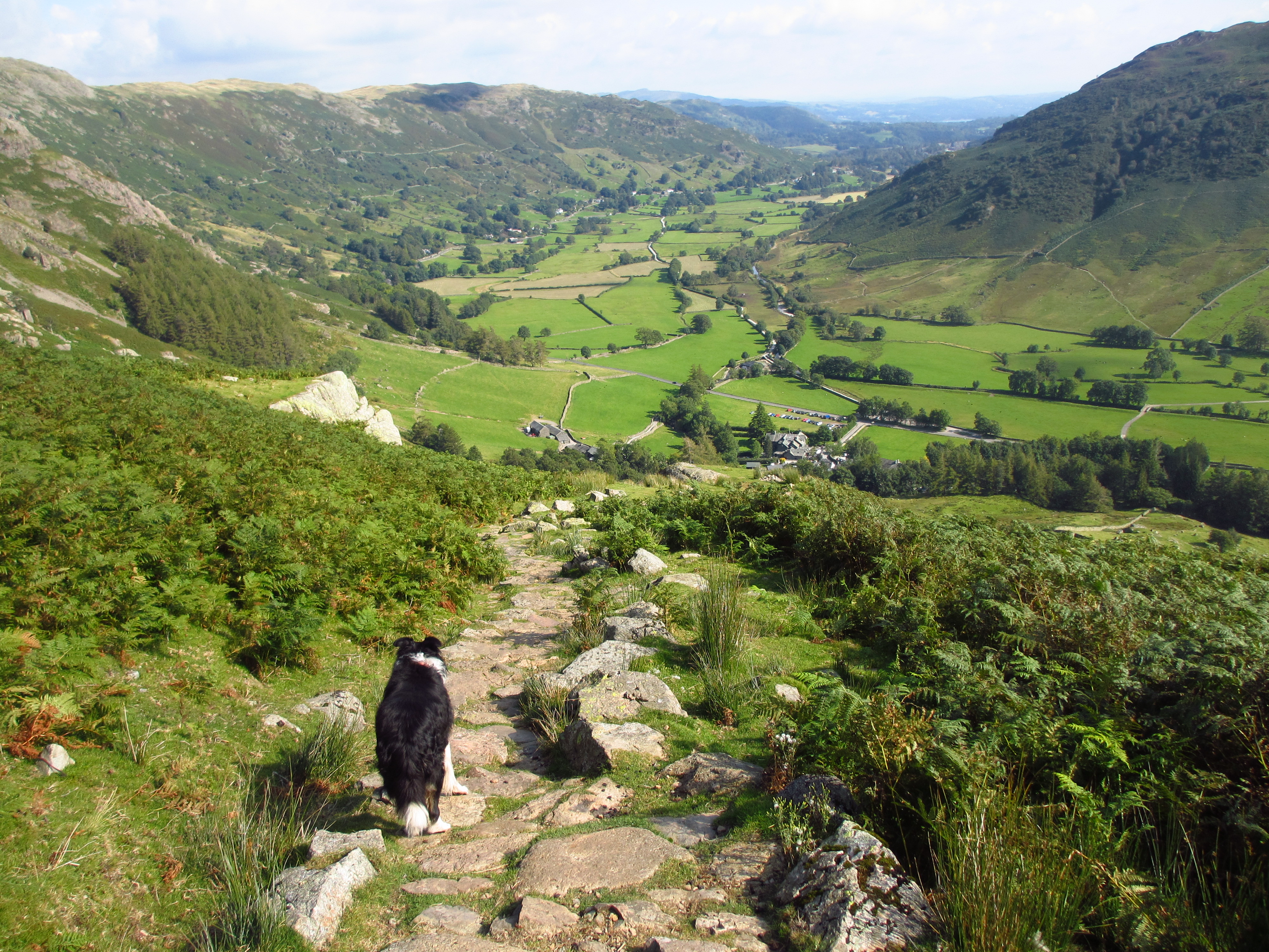
From where we parked the car...... Catbells on the left, Maiden Moor in the centre and the steep, lower slopes of Causey Pike on the right with the very edge of Barrow far right. There was a bit of a walk to reach the lower slopes of Causey Pike but we had parked just by a vague bracken-track heading up Barrow in the hope that we would be able to navigate down the slopes of Barrow directly back to the car.....we are always optimistic!

From the start of the track up to Rowling End, the summit seen off to the right.

Looking across Derwent Water to Blencathra on the left and Clough Head on the right.

Maiden Moor and Dale Head. The way up to Causey Pike is as steep as it looks!

A walk from a couple of weeks ago..... Dale Head, Hindscarth and Robinson.

The heather is starting to look good! Walking through the heather before the final pull up to the summit. Scar Crags, Sail and Eel Crag seen behind. Ard Crags on the left.

Looking back down to Rowling End.

Causey Pike summit looking along the ridge to Scar Crags, Sail and Eel Crag.

It was still warm at this point, but fleeces were to go on in a few minutes as the cold winds picked up.

Scar Crags summit looking back to Causey Pike.

High Crag, High Stile and Red Pike. Cloud was starting to encompass the surrounding mountains.

Taken from the long haul up to Sail looking back to Scar Crags and Causey Pike. We would return this way but take a left at the bottom. The Sail Pass will lead us on to the three smaller hills on the left....Outerside, Stile End and Barrow. Behind them is Skiddaw.

Close-up of the clouds on Blencathra.

Eel Crag. The mist has begun to drift over it was very windy so it was moving fast. Time to put on my jacket .

Looking at the edge of Buttermere from the same place.

A couple of minutes later the clouds were almost upon us. The bad weather had come 45 minutes earlier than expected.

View down the other side down the Coledale Valley mist here too! We climbed up Eel Crag into the ever thickening mist.

Trig point......nothing to see! Grasmoor should be behind me. We headed off down in the very strong winds.....and then the rain started.....humbug!

By the time we reached the Sail Pass the rain had abated but it would be drizzling constantly by the time we were walking up Outerside....Two people are on the far left of the track.

Ged and Kas a bit soggy on Outerside summit.

Looking through the mist at Stile End with Barrow beyond

The route down Barrow ridge, still misty.

Looking across a black Derwent Water.

It brightened up below the clouds. Just in the dip ahead we located a path off right down through the bracken.

Looking across Braithwaite to Bassenthwaite Lake.

The path zig-zagged through the bracken and was steep and slippery after the rain. The bracken must have been eight foot high in places. It was very wet and I was glad I was dressed top to toe in waterproofs.