| Name of walk | Castle Crag, High Spy and Maiden Moor |
| Date of walk | 2008-04-28 |
| Distance walked (miles) | 8 |
| Duration of walk | 6 hours 0 minutes |
| Weather | Sunshine then rain |
| Peaks on walk | Castle Crag, High Spy and Maiden Moor |
| Walked with | Ged and blind Kas |
| Parking | parking spaces on main road outside Grange. |
Yesterday Ged, Kas and I set off for Borrowdale to climb the smallest Wainwright, Castle Crag (956ft), plus High Spy (2143ft) and Maiden Moor (1887ft). The forecast was for heavy rain, but there was to be good visibility out of the rain.

We parked on the other side of the river from Grange. The photo below is taken from the double bridge over to Grange. Castle Crag is in the middle and High Spy is the biggie on the right.

We walked through Grange and took the turning past the cafe and followed the river through woods to where it opened up, just below the slopes of Castle Crag. High up on the slopes on the right are some caves, including the one that Millican Dalton the mountaineering adventurer used to live in, but I decided to keep the exploration of those for when I come here with Tom.


The route up to Castle Crag is on the right, up the scree.

It was warm today.

Ged on the route up the quarry spoil heap. There were quite a few people on the summit too, all retired folk by the look of it.

View south from the quarry level to Rosthwaite.

The quarry and its standing stones.

View out to Derwent Water and Skiddaw from the summit.

The summit cairn and War Memorial to the Borrowdale men lost in World War One.

It was a sheer drop into the quarry below so we had to keep Kas on his lead, as he is blind. View out to Great Gable, the Scafells.

We had lunch looking at the view.


From there we headed up the valley to Tongue Gill and made are way up towards High Spy. The route up Tongue Gill looking over to Wantendlath Fell.

On the way up we passed some of the ruins of Rigghead Quarry. There were also some open old mine levels to have a look in.

The route back down.

The weather had started to change, we could hear thunder, the skies were turning black and we felt spots of rain. We stopped here to put our waterproofs on and then continued our exploration of the buildings, mines and caves.


Black clouds moving in from the south.

By the time we reached the view to Dale Head it was raining.

Then we had hailstones.

But by the time the summit cairn of High Spy came into view the rain had passed. The wonderful black mountain range of Causey Pike and Sail etc behind

The route up to Robinson and Causey Pike and Sail etc behind.

Our route north. Bassenthwaite Lake on the left.

The far mountains behind me are the ones I did in mist last Wednesday. From left is Clough Head, the minute peak of Calfhow Pike, Great Dodd, Watsons Dodd, Stybarrow Dodd and Raise

The view from Blea Crag over Maiden Moor.


Causey Pike. These mountain are covered in heather and look stunning in summer. I must return when the heather is flowering.

From Maiden Moor looking down to the peaks of Catbells. The skies above Skiddaw and Blencathra looking very dark.

Derwent Water and Bleaberry Fell.


Looking down to the road.

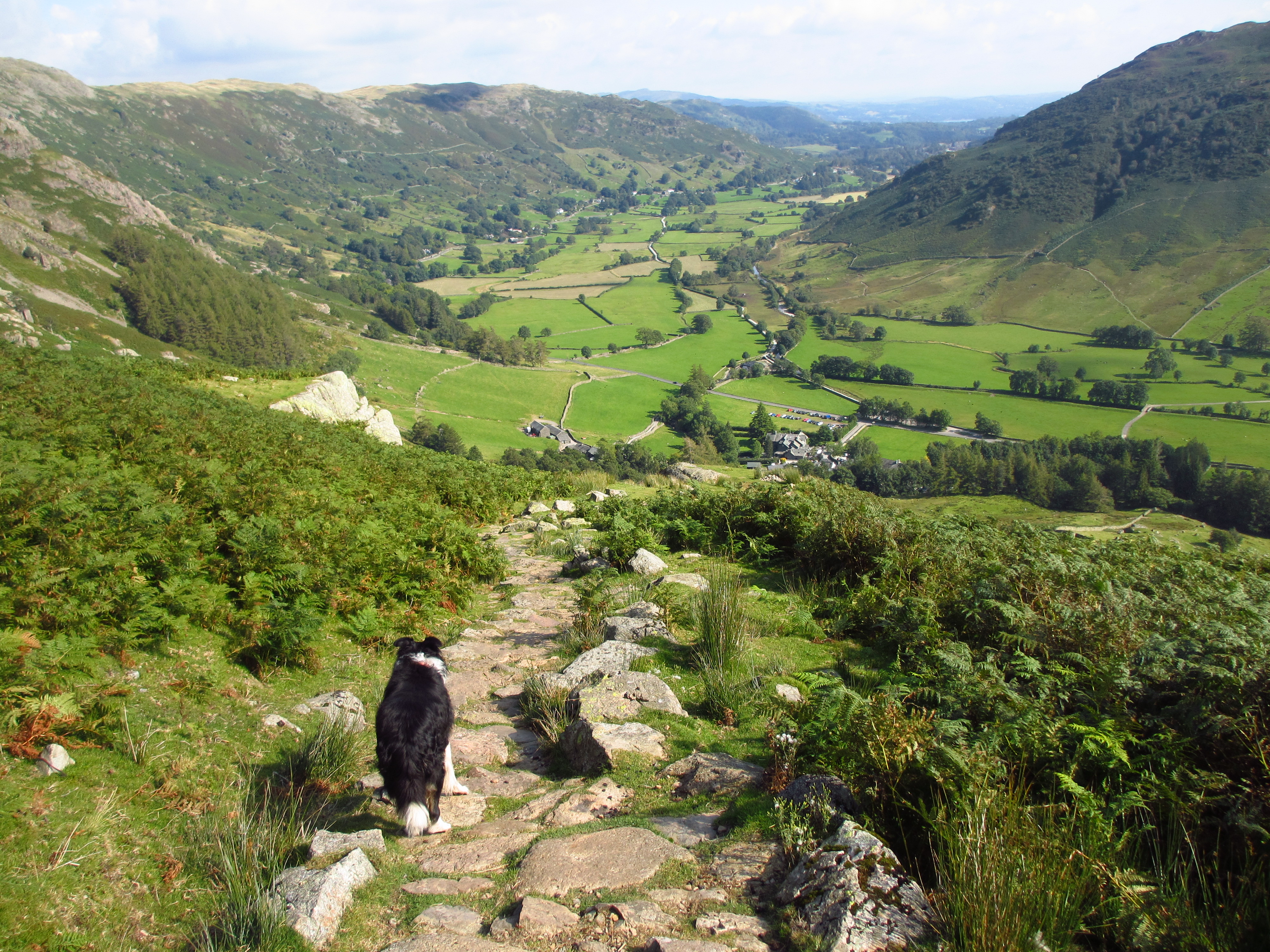
Kas leads the way down the path.

From the road Castle Crag can be seen again in the middle. We walk back along the road through Manesty to Grange.

Holy Trinity Church in Grange, built 1861.

We had a coffee in the cafe in Grange that we passed on the way, sitting outside in the sunshine, and then headed back to the car. The walk took under six hours and was about eight miles.